Welcome to the Rudloe and environs website.
Here you will find news, articles and photos of an area that straddles the Cotswold Area of Outstanding Natural Beauty in north-west Wiltshire.
Contributions in the form of articles or photos are welcome. Even those with completely contrary views to mine!
Thanks to the website builder 1&1 and Rob Brown for the original idea.
Rudloescene now, in January 2014, has a sister, academic rather than anarchic, website about Box history here: http://www.boxpeopleandplaces.co.uk/
It contains thoroughly professional, well-researched articles about Box and its people.
Contact rudloescene through the 'Contact' page.
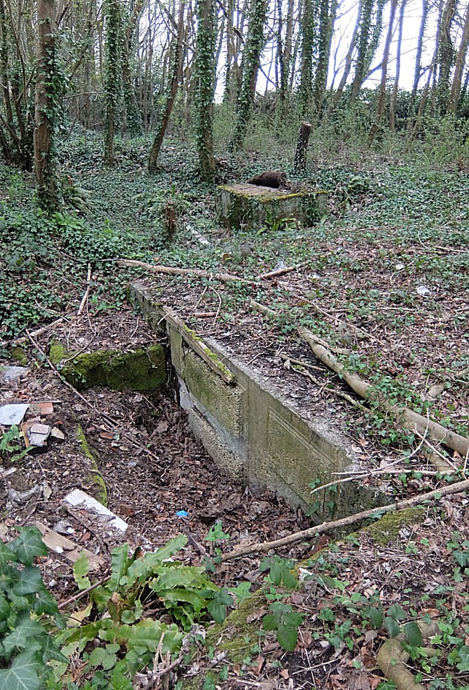
The title photo shows some surface structures in the area of the access shaft to the old Brewer's Yard Quarry at Rudloe Firs. This quarry is long-abandoned but now there is a new proposal for a slope shaft and associated paraphernalia for Hartham Quarry at the northern side of Rudloe Firs (beyond the woodland). The planning application for this proposal has received Wiltshire Council's designation 19/07824/FUL, representations on same must be made by Thursday, 12th September 2019.
30th July 2025 - planning application PL/2024/01183 sought to discharge conditions 4, 11, 12 and 24 of application 19/07824/WCM. These conditions were related to the requirement for a construction and environmental plan (4), a scheme for the discharge of surface water (11), the disposal of sewerage (12) and various items concerning storage of materials and methods of working (24). It isn't clear from the (limited) documents whether any of these conditions have been discharged.
Work on a planning application is supposed to commence within three years of the application being granted. The decision notice on 19/07824/WCM was dated 12th April 2021 so the application is now over a year 'out of time'. I have asked Wiltshire Council's enforcement section whether 19/07824/WCM is still extant*.
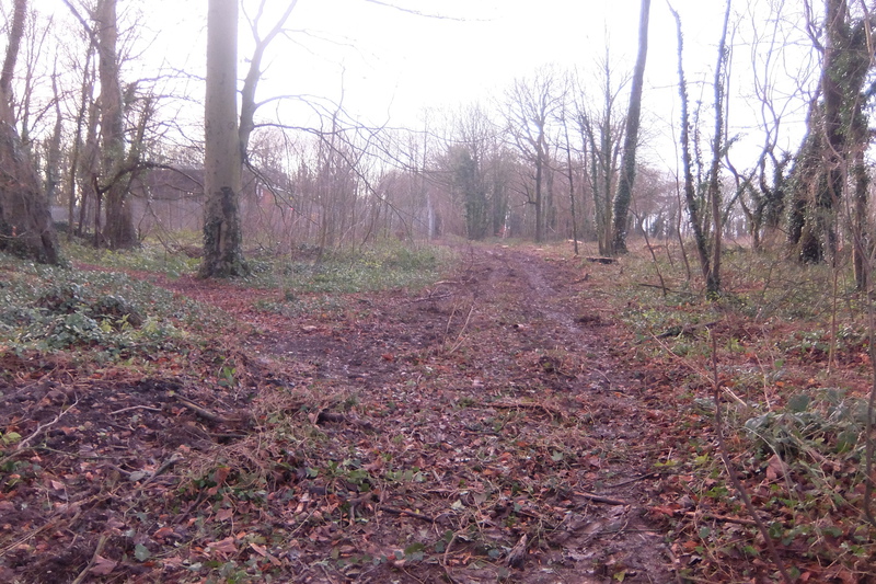
In the gallery below, you will find some pictures of the Rudloe Firs woodland taken on 28th July and pictures of the proposed site. The site, which would normally have been down to a crop (perhaps wheat or barley) is currently 'wild' (perhaps not a bad thing).
* I have had a response (1st August 2025) from Wiltshire Council's Economic Development & Planning department - it looks like the destruction of a swathe of woodland (see 5th December 2021 article below) to enable access to the site constitutes the 'start of work', in their words: "If any works had started before the 3 years expiry date of 31 March 2024 then this would be ok".


6th January 2022 - having delved into the S106 agreement between the parties involved, we come to revisit the ownership of Rudloe Firs woodland. The 'parties involved' were: 1) Wiltshire Council, 2) James Guy Battrick Stafford, Michael Peter Cavalla and Matthew James, all as executors of Guy Byram Stafford, 3) Jonathan James Norman Cheetham and Olda Ann Fitzgerald as trustees of the Georgina Willes Grandchildren's Trust, 4) Hartham Park Minerals Ltd, 5) The Bath Stone Company and 6) Lloyds Bank, and the agreement is dated 31st March 2021.
Whilst party 3) was the owner of Rudloe Firs woodland at this time, there was a 'right to purchase' (licence and option) agreement dated 20 March 2019 made between J.J.N. Cheetham and O.A. Fitzgerald (party 3) and Hartham Park Minerals Limited (party 4). This agreement came to pass on 23rd June 2021 when Hartham Park Minerals purchased the woodland for £330,000. One wonders how this affects the S106 agreement as one of the parties has transferred ownership of land to another party since the signing of he agreement.
Wardell Armstrong's document 'Response to Comments' refers to the Arboricultural Impact Assessment. No such document is to be found in the Wiltshire Council documents list of planning application 19/07824/FUL. Little attention appears to have been paid to the value of the woodland here which, whilst it may not contain a plethora of different species, is, like any woodland, an important 'green lung' and refuge for animal life. But as it is not protected, the new owners with their principal interest of extracting stone, seem to be running roughshod over any appreciation that the woodland is meaningful green space. (For some recent photos of the northern edge of Rudloe Firs woodland before the devastation began, see Walks in the Time of Covid v)
Now we come to the rather odd ownership of the woodland prior to the June 2021 change. This was, as indicated above, the Georgina Willes Grandchildren's Trust. So who was Georgina Willes and who are her grandchildren? Georgina was the mother of Olda Ann Willes, the second wife of Desmond John Villiers Fitzgerald, 29th Knight of Glin also known as the Black Knight (see https://wiki2.org/en/Desmond_FitzGerald,_29th_Knight_of_Glin). And the grandchildren of Georgina? They are Nesta, Honor and Catherine. Any the wiser? Well Catherine provides the local connection; she is married to actor Dominic West; they live in Slaughterford. So, in lieu of the trust, one presumes that Catherine, Nesta and Honor have recived a substantial windfall (and, actually, a much larger amount than woodland would normally command) for one of our local woods. Should I repeat Winston Churchill's take on landownership?
'Land is by far the greatest of monopolies. Consider the enrichment which comes to the landlord who happens to own a plot of land on the outskirts or at the centre of one of our great cities. The landowner need only wait while other people work and pay taxes to make the city grow more prosperous: building businesses, installing roads and railways, paying for schools and hospitals and public amenities. All the while the land monopolist has only to sit still and watch complacently his property multiplying in value, sometimes manifold, without either effort or contribution on his part; and that is justice!'
31st December 2021 - the diagram below taken from the S106 agreement of planning application 19/07824/WCM shows the site of the new slope shaft to Hartham Quarry in blue and the access road through Rudloe Firs woodland in yellow and green..
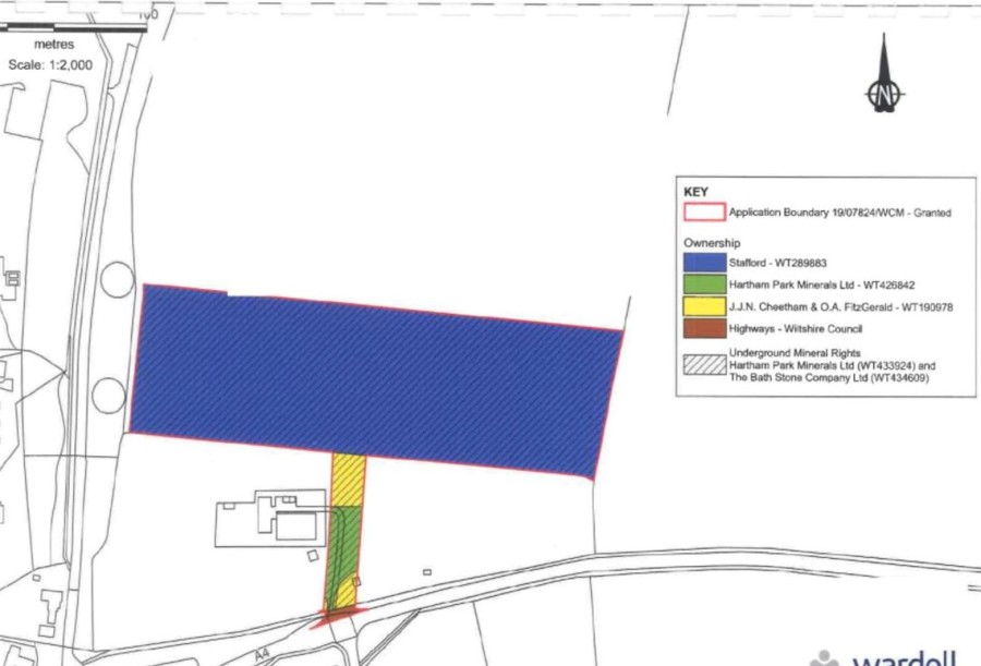
Wardell Armstrong's Bat Ecological Impact Assessment includes the following in para 4.6.3: "The woodland to the south of the site will be retained" (this is the woodland to either side of the yellow/green access corridor). It goes on to say: "However, the development will result in the loss of some of this woodland habitat to accommodate access into the site from the A4. The existing track will be widened to approximately 7.3 metres at the junction with the A4 to accommodate two lanes entering the site. The access road will narrow to a single lane approximately 4.5 metres wide". Other documents confirm this proposed plan.
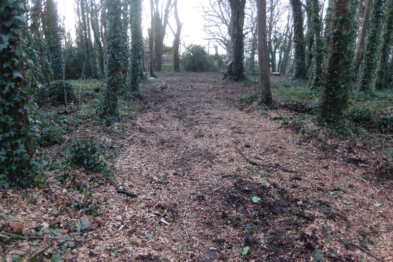
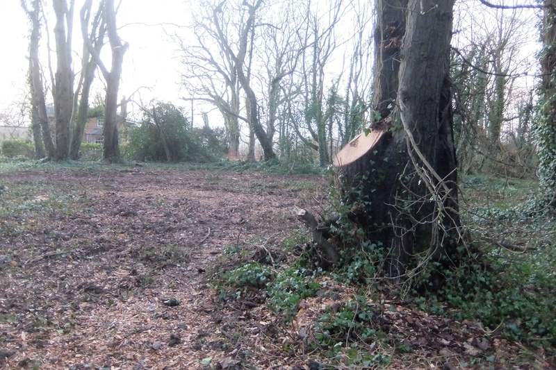
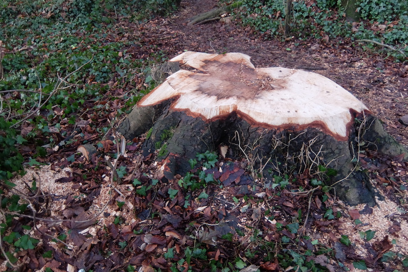
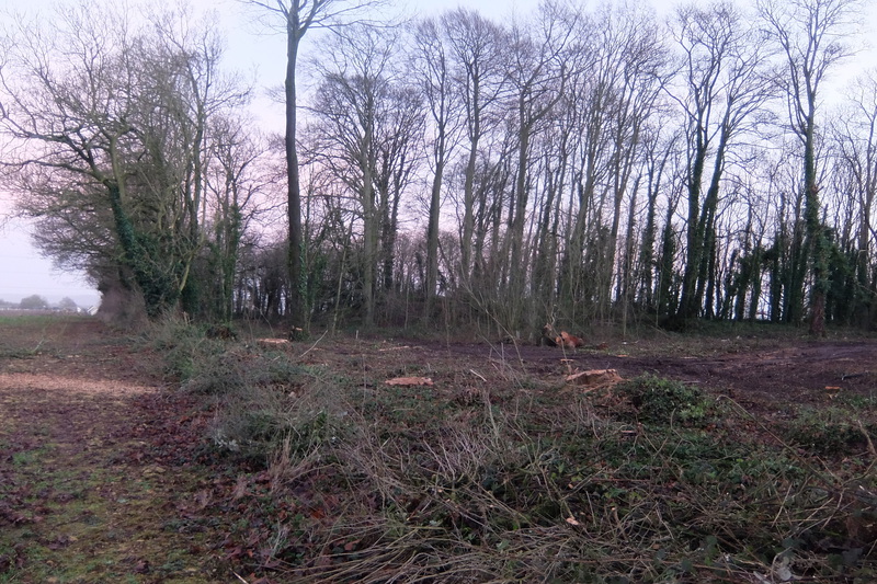
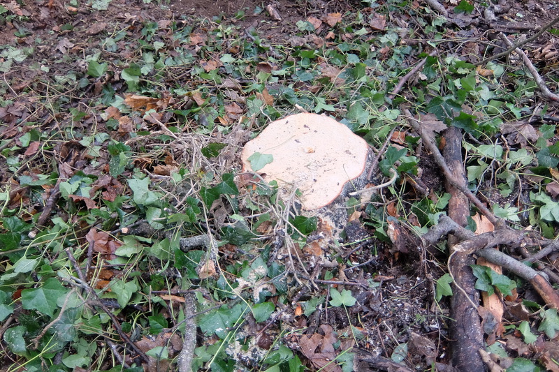
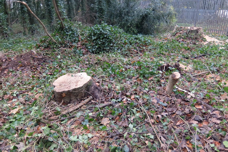
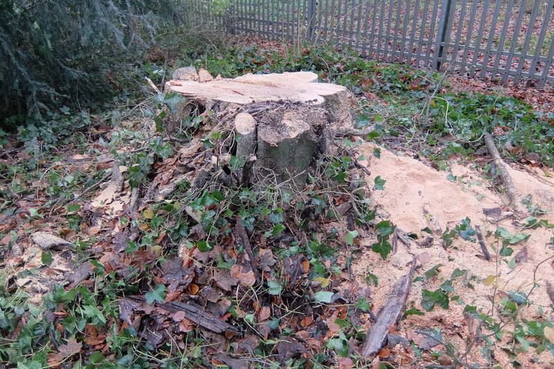
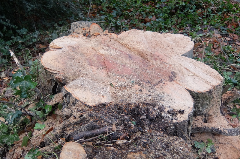
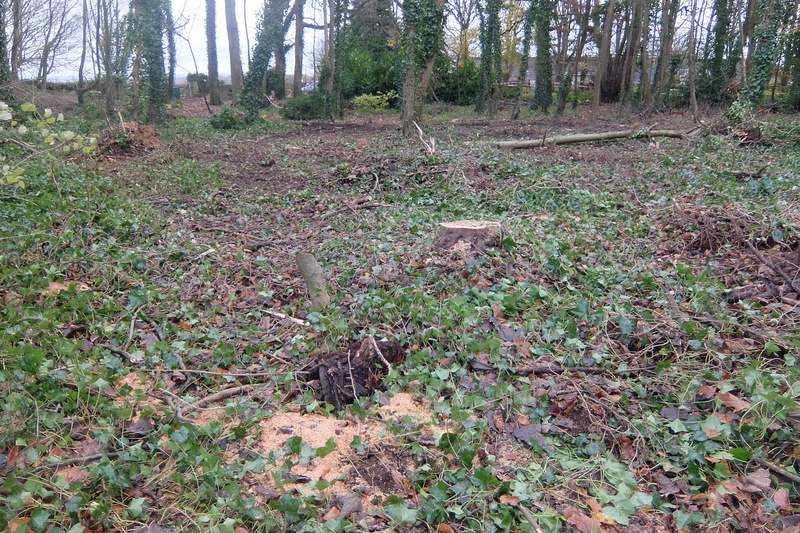
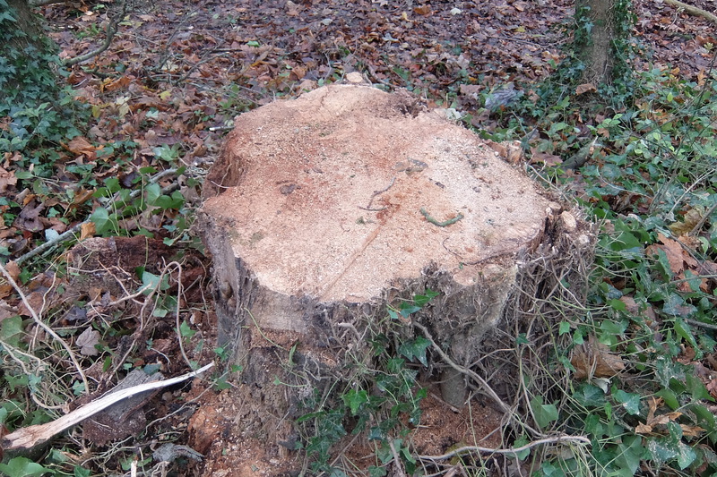
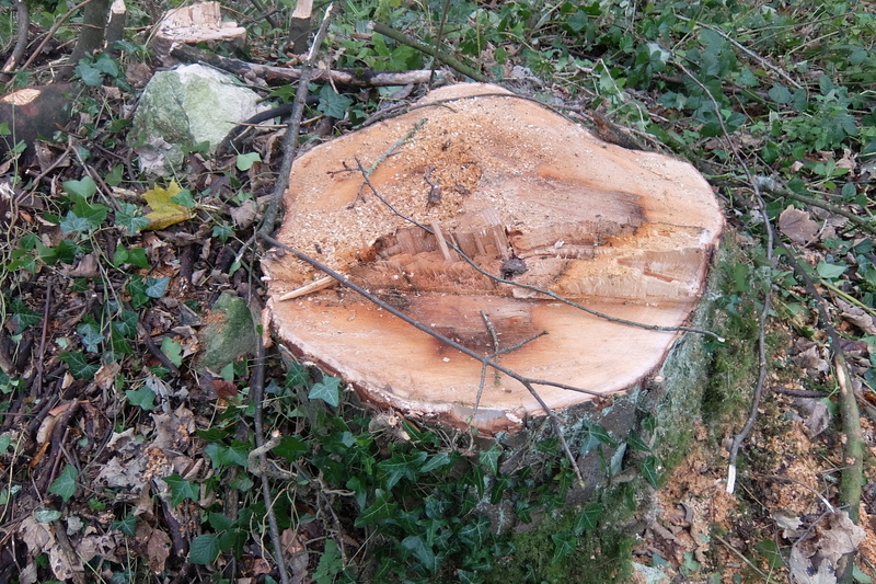
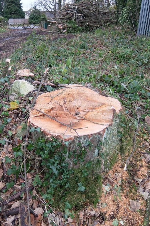
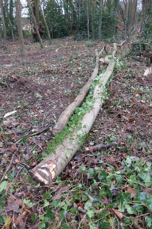
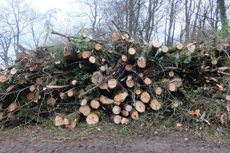
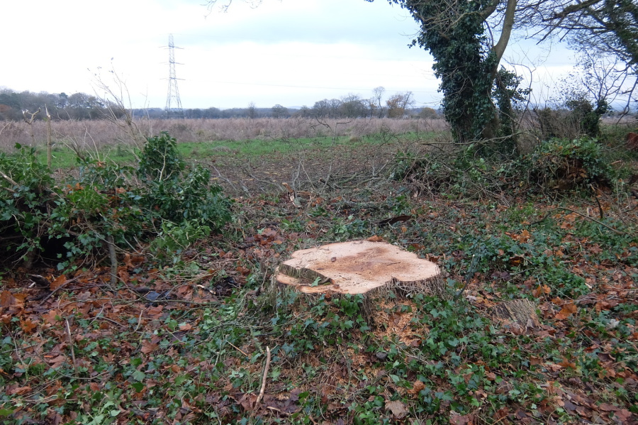
But this is not what has come to pass. 'They' have cut lateral tracks, one running west, the other east from the access track, resulting in the loss of dozens of trees. The following photos, taken on 29th December 2021, show the devastation that has been brought about in Rudloe Firs woodland. The first gallery below shows the track leading to the western edge of the woodland, close to Foxfire Lodge; the stump is that of a mature sycamore.

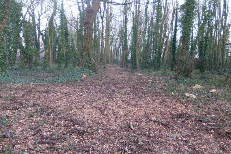
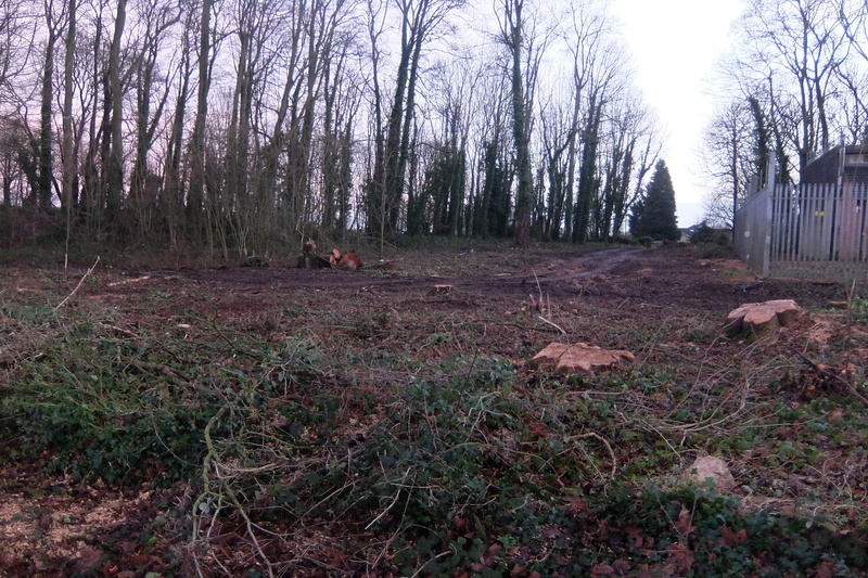
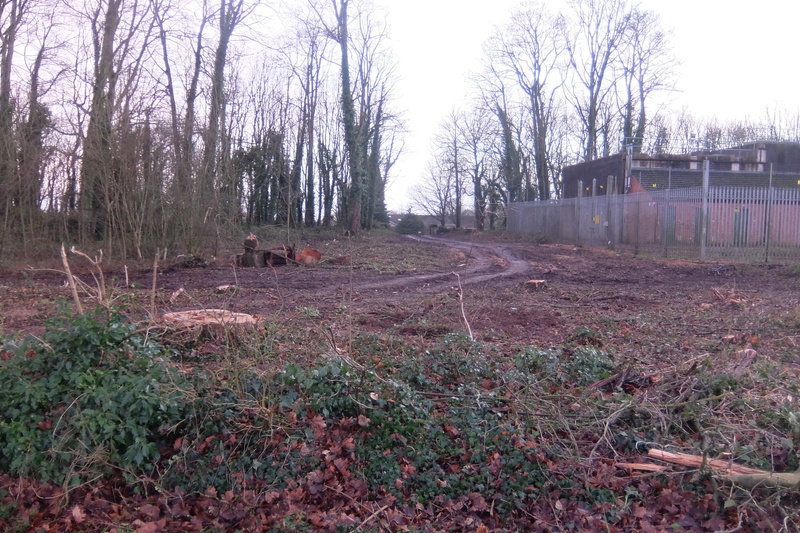
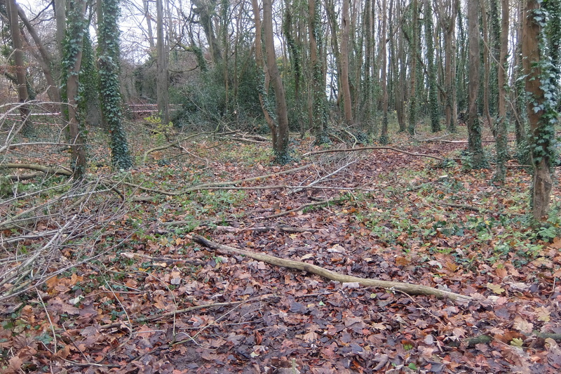
The gallery below shows the track running to the eastern edge of Rudloe Firs.
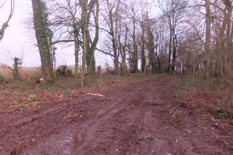
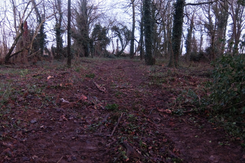
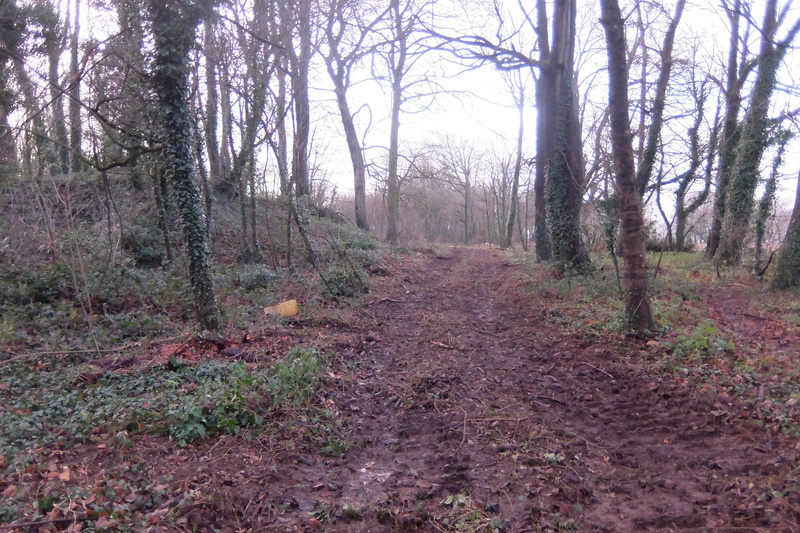
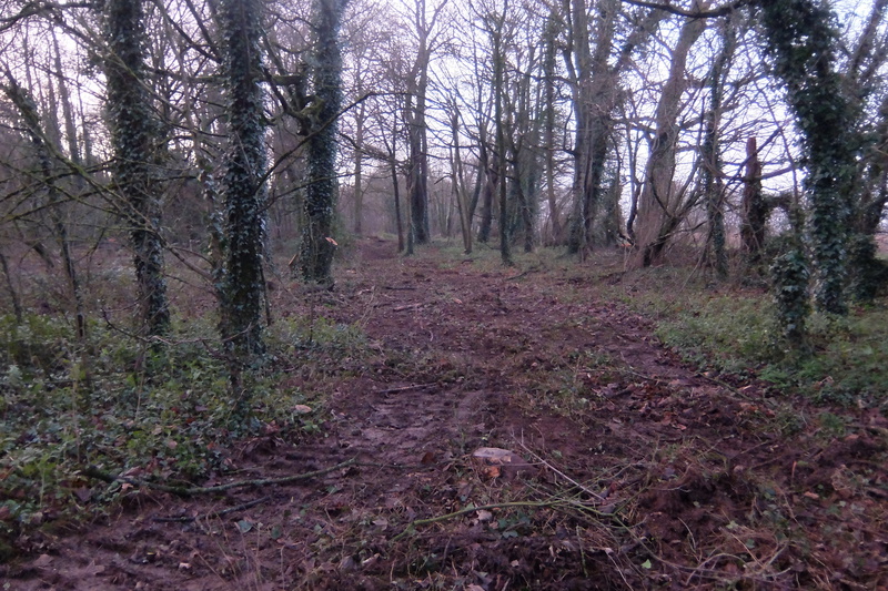
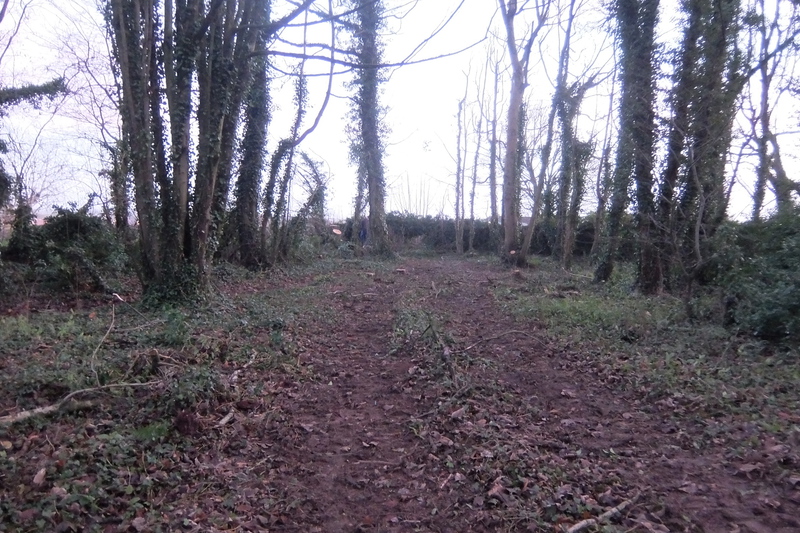
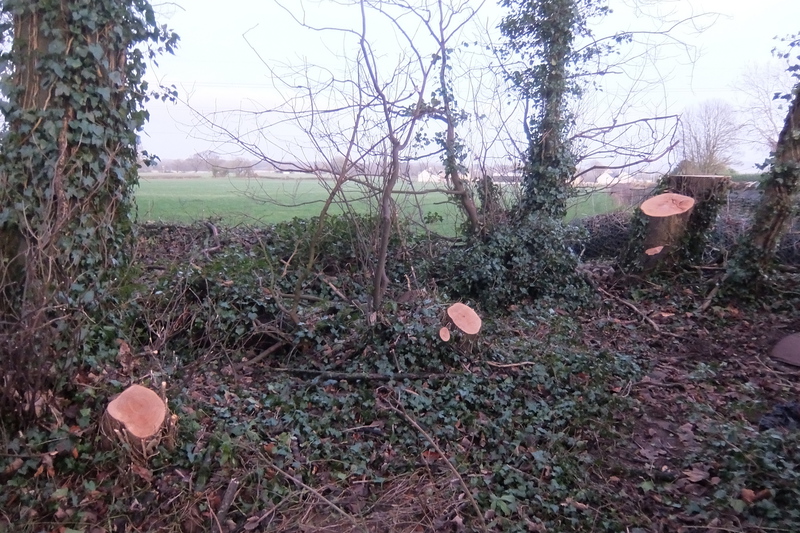
And finally, the gallery below shows the supposedly 7.3 metre-wide access track (or actually, 4.5 metre-wide at this northern, slope-shaft end) which looks more like a 20 metre-wide swathe.

In document Wardell Armstrong Response to Comments, we find the following: Six trees will need to be removed to create the proposed entrance to the new mine entrance. Pruning will be required to the trees adjacent to the proposed entrance road to provide sufficient clearance for the vehicles using the road while protecting the main canopy. The photographs above, and in the 5th December article, demonstrate that the applicant has been "economical with the actualite".
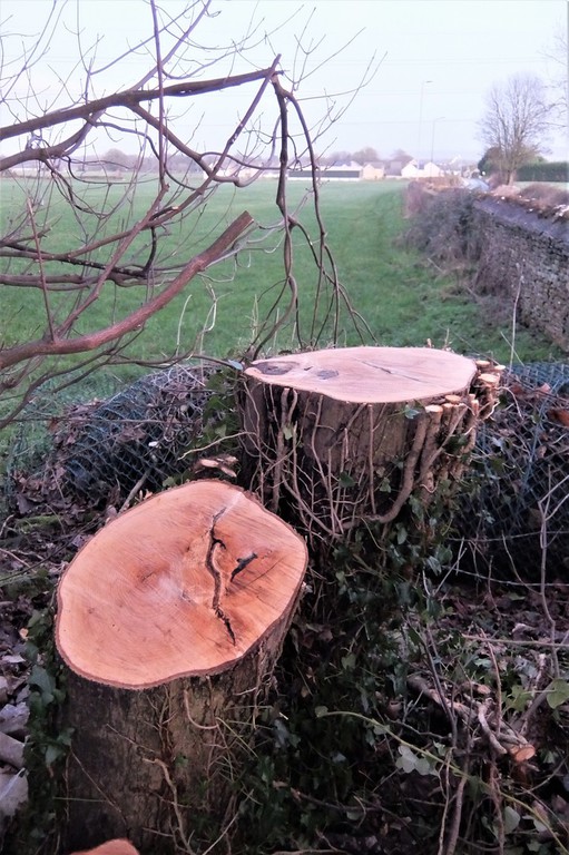
5th December 2021 - desolation at Rudloe Firs signals the start of works for planning application 19/07824/WCM. Quite a number of trees in the woodland have been removed as well as those which would have blocked the access to the proposed slope shaft.
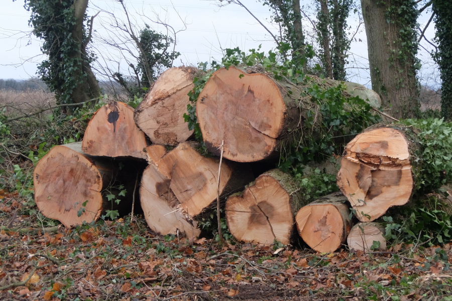 Quite possibly 500-years-worth of mature trees have succumbed to the chainsaw here. I'll quote James Lovelock again: "The chainsaw is an invention more evil than the hydrogen bomb".
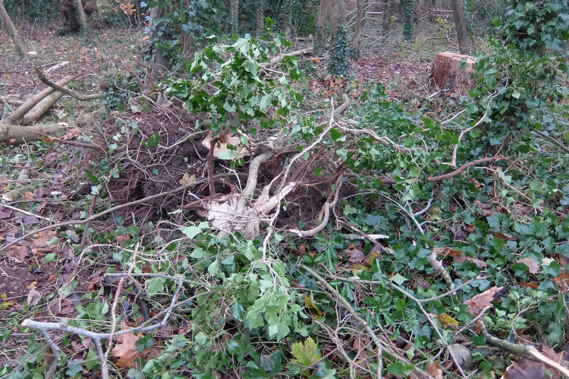
The stumps in the gallery below are in the woodland to the west of the track leading to the proposed slope shaft. According to studies, one large tree can provide a day’s supply of oxygen for up to four people - Rudloe is being deprived of oxygen! Seriously, as far as I know, the felling of these woodland trees was not part of the slope shaft planning application.

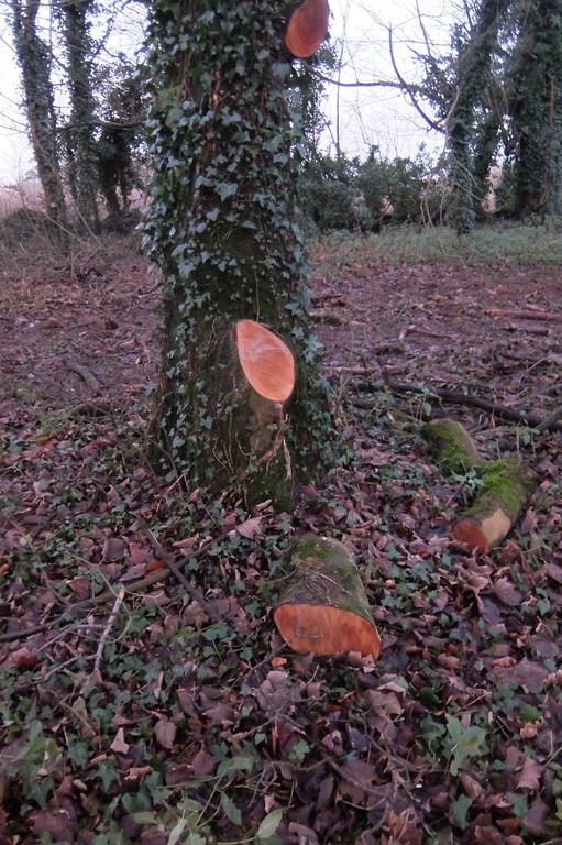
 Scores of semi-mature trees have been felled to clear the track leading to the proposed slope shaft
 Plenty of potential habitat lost here


 And here's a mature tree that was in the path of the new track
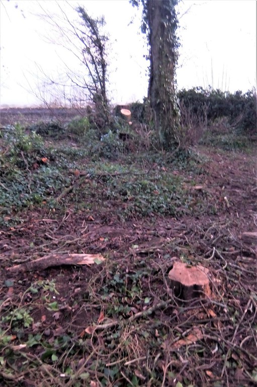
 A lost mature tree with the site of the proposed slope shaft beyond


21st December 2019 - a response, dated 10th December, to the various objections raised regarding this proposed development has been lodged by consultants Wardell Armstrong Wardell Armstrong response. As indicated in the 11th September 'update' below, of the 157 objectors to this planning application, not a single one objected to the previous slope shaft application, 15/00712/WCM, in the Bradford Road just half-a-mile away. That application would have seen, inter alia, two 30-metre long, 7.5-metre high steel-cladded buildings plus other substantial stone yard paraphernalia blighting the 'important view' (ref Wiltshire Landscape Character Assessment, 2004) shown in the first photograph of the 28th August article below and would also have ruined the outlook on the south-western approach to Corsham along the Bradford Road. Yet 157 people are now objecting to a slope shaft and yard effectively hidden from view to the north of Rudloe Firs woodland! Further representations on this planning application which has received the new designation 19/07824/WCM are required by 31st December 2019.
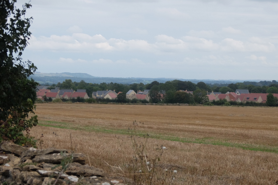
28th August 2019 - as with much of modern life, there is much more to this application than meets the eye. Let's start with a view designated as 'important' by the Wiltshire Landscape Character Assessment of 2004; such important views are further prescribed in Wiltshire Core Strategy Policy 51.

This view from the A4 close to Rudloe Firs looks across the local area in the region of Bradford Road and Park Lane; Bowden Hill lies in the middle distance with Oliver's Camp on the western escarpment of Marlborough Downs beyond. Although shrouded in mist in this view, Pewsey Vale (with the source of the Salisbury Avon close to Burbage) and Salisbury Plain lie further beyond. A timeless view laid down in the Jurassic and Creataceous periods.
The Wiltshire Landscape Character Assessment mentioned above, in addition to the important views, stated that a separation should be maintained between Corsham and outlying settlements such as Rudloe and Neston. This was further affirmed in Corsham Town Council's Strategic Plan 2014-18 and became known as the 'strategic gap'.
So what happened?
So much for plans and strategies which have been formulated over many years at much ratepayer expense. All these count for nothing if a trump card is held; that card is 'sustainable development', held by government. So now, another question - why mention all this here in an article about a proposed new slope shaft beyond Rudloe Firs providing access to Hartham Quarry?
The original plan from the Hanson organisation for a new slope shaft for its Hartham Quarry followed the termination, by the owner of the Pickwick slope shaft, of the agreement for Hartham Quarry access through the Pickwick shaft. A new slope shaft was proposed in the 15-acre field owned by Hanson, pictured above, adjacent to the Bradford Road.
But then Hanson apparently lost, or was persuaded to lose, interest in the Hartham Quarry enterprise by the applicant for the Rudloe Firs slope shaft project, one Nicholas Matthew Middlemas Johnston. Mr Johnston is the principal director of: Vision Motorsport Ltd, Monks Park Minerals Ltd, Flick Quarry Ltd, WANS6 Ltd, Great Tew Properties Ltd, Great Tew & Bantham Estates LLP, GTBH Ltd, Mullin Automotive Museum Ltd, Stone Processing Sales Ltd, The Johnston Quarry Group Ltd (previously Oathill Quarry Ltd), Bantham Holdings Ltd, Hartham Park Minerals Ltd (previously WANS3 Ltd), Bath Stone Group Ltd and The Bath Stone Company Ltd. It is as a director of the last of these, The Bath Stone Company, that Mr Johnston made the application for the Rudloe Firs slope shaft.
But what about the site of the original slope shaft proposed by Hanson in its field adjacent to the Bradford Road? This field had been owned by The Bath & Portland Stone Firms then by Hanson for many years but then in November 2017, the title of the land was given over by Hanson Quarry Products Europe Ltd to Great Tew & Bantham Estates LLP for the princely sum of £1,204 and a transfer of the land was made to Johnston Quarry Group.
There are mining/quarrying reasons for the location of the slope being a better option to the north of the A4 as this is where the extractable stone lies; the stone to the south of the A4 is cross-bedded towards the west (Rudloe) and not economically extractable. However, in the current climate of housing development in every conceivable corner of west Corsham (and everywhere else), Mr Johnston knows that a 15-acre field adjacent to a principal, arterial route in west Corsham is not stone mine material, it is gold mine material thanks to the government's trump card of sustainable development. He has, by design, a 15-acre greenfield development site on his hands; at £1 million per acre for development farmland in southern England, this is a veritable gold mine. So, should the Rudloe Firs slope shaft gain planning approval, watch out for the following planning application for housing in the Bradford Road.
Should this come about, the 'important view', designated in the Wiltshire Landscape Character Assessment and also asserted in Wiltshire Core Strategy Policy 51, from the A4 across local farmland towards Bowden Hill, the Marlborough Downs, Pewsey Vale and Salisbury Plain will be thoroughly ruined. And so much for Corsham Town Council's Strategic Plan of a strategic gap between Corsham and outlying settlements and the avoidance of a west Corsham conurbation. This will be yet another local example, following those of Stafford, Gibbons, Payne and Watt, of landowners making hay (excuse the pun) at the expense of the local community, local and county councils, local services and the landscape including (ironically) farmland and designated, important views.
'Land is by far the greatest of monopolies. Consider the enrichment which comes to the landlord who happens to own a plot of land on the outskirts or at the centre of one of our great cities. The landowner need only wait while other people work and pay taxes to make the city grow more prosperous: building businesses, installing roads and railways, paying for schools and hospitals and public amenities. All the while the land monopolist has only to sit still and watch complacently his property multiplying in value, sometimes manifold, without either effort or contribution on his part; and that is justice!'. This was Winston Churchill's take on landowners.
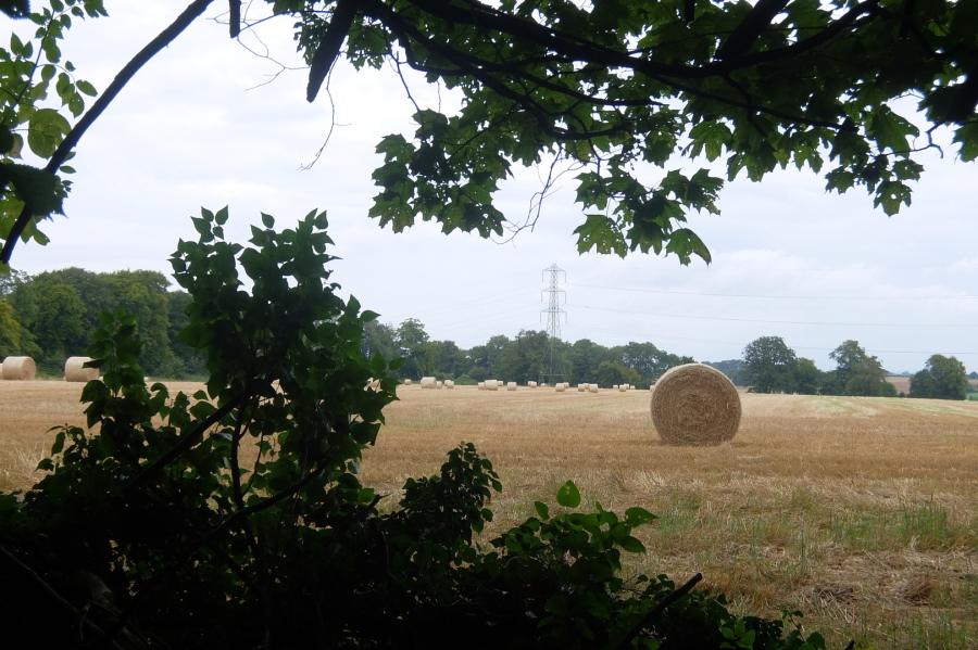
Now let's move on to the Rudloe Firs site. The field beyond (to the north of) Rudloe Firs was down to barley this year, the barley straw bales are shown in the picture below which was taken from Rudloe Firs; this is the location of the proposed slope shaft. In the grand scheme of things, I suppose it is just by the by that this scheme would result in the loss of a substantial number of mature trees in the Rudloe Firs woodland.
Here, we perhaps have another example of the landowner shafting the local community as well as a quarry. This field is, or was, owned by Guy Stafford - he of the sell-off of 23 acres of farmland in Pickwick to the iniquitous Gladman organisation (an inquiry into that greenfield development is now scheduled for 2020). In July 2019, Stafford sold part of the field, adjacent to Rudloe Firs, to Mr Johnston's Hartham Park Minerals Ltd thus enabling the shaft (and Bradford Road) scheme. Pure speculation of course but I guess that the cut proposed in this field will not be the only one.
But there's something very odd about the application for this new slope shaft. I may well be missing something as the trappings of company and land ownership are deliberately tortuous (in this country!) but two of the names given on the application as 'Owner/Agricultural tenant' vis Jonathan James Norman Cheetham supposedly of 'Darham', Norfolk and Olda Ann Fitzgerald of Glin Castle, Limerick (I say 'supposedly' above as Darham doesn't exist, this should say Dereham) are not owners and they cannot, surely, be agricultural tenants with each living in a remote part of the realm (or outside the realm in the case of Limerick). So who are these two people?
The story will surely continue; watch this space ...
11th September 2019 update ...
With regard to the question of the two supposed owners who do not appear on the Land Registry proprietorship register (see 6th January 2022 article), Sue Maidment has provided the following information: "The grandfather of Olda Ann Fitzgerald, a Mr Willes, was the owner of woodland at Rudloe before ownership passed to Nick Mason; Jonathan James Norman Cheetham is the land agent that manages the woodland as did his father before him".
A further thought ... as of today, 35 people have objected to this application yet not one of those 35 objected to the previous application for the slope shaft in the Bradford Road, less than a half-mile away.
26th September 2019 update ...
More than a tad late in reporting that the deadline for representations has been extended to Tuesday 1st October and a reminder that approval of this planning application would result in a 'double whammy', the second part of which would be an application for housing development at the formerly proposed slope shaft site in Bradford Road.