Welcome to the Rudloe and environs website.
Here you will find news, articles and photos of an area that straddles the Cotswold Area of Outstanding Natural Beauty in north-west Wiltshire.
Contributions in the form of articles or photos are welcome. Even those with completely contrary views to mine!
Thanks to the website builder 1&1 and Rob Brown for the original idea.
Rudloescene now, in January 2014, has a sister, academic rather than anarchic, website about Box history here: http://www.boxpeopleandplaces.co.uk/
It contains thoroughly professional, well-researched articles about Box and its people.
Contact rudloescene through the 'Contact' page.
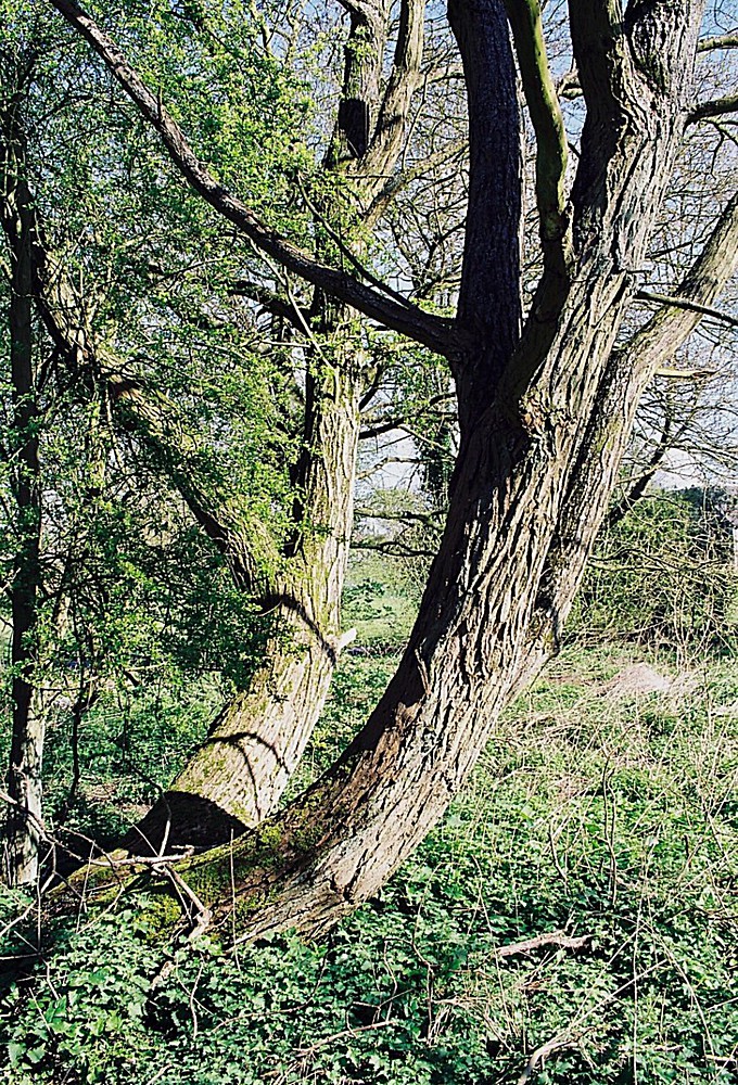
The title pictures show goat willows at the Donkey Field in the 1990s and the 'chainsaw man' finishing off these substantial trees after their felling. Quoted elsewhere but let's hear from James Lovelock again ... "The chainsaw is an invention more evil than the hydrogen bomb". I don't know about that but I do know that a high-pitched screaming chainsaw creates a feeling of intense unease as do remote, predatory developers whose sole interest is fat profits at the expense of the local environment and local people.
A speculative development proposal for the Donkey Field from a company by the name of Summix was lodged on 12th October 2018; planning permission was refused by Wiltshire Council on 20th September 2019. Summix then appealed to the Planning Inspectorate who held an appeal hearing on 8th/9th February 2021 where the appeal was allowed subject to conditions. However, Summix found themselves unable to satisfy the conditions, specifically those relating to surface water drainage and sewage and so decided to cut their losses and sell the site to Ark Data Centres who propose to build another data centre (adding to their existing five) on the site - the planning application PL/2024/05527 is discussed and impugned by Trudy Davies in the 16th September 2024 article below.
Note that development news prior to 2018 may be found in the parent webpage Westwells/Neston and many pictures of Donkey Field destruction in 1998/9 and 2002/3 may be found at Localities/Westwells/Donkey Field destruction here Donkey Field destruction.
25th May 2026 - a further update from the Neston and Westwells Action Group (NWAG) on the proposed Donkey Field development may be found in the .pdf file below.
Adobe Acrobat document [123.9 KB]
23rd April 2026 - an update from the Neston and Westwells Action Group (NWAG) on the concerns raised about how a major local planning decision was presented and considered at the Wiltshire Council Strategic Committee meeting (from Neston News - April 2026}. This relates to planning application PL/2024/05527 - the Donkey Field data centre application from Ark Data (see articles below).
Adobe Acrobat document [81.8 KB]
20th February 2026 - following the Wiltshire Council decision, there follows a synopsis (in the 'pdf file below) of the current situation from Morgyn Davies, Westwells resident and leading campaigner in the fight to save the Donkey Field:
Adobe Acrobat document [101.7 KB]
10th February 2026 - the Wiltshire Council Strategic Planning Committee meeting on PL/2024/05527 - Land South of Westwells Road, Westwells Road, Neston, SN13 9GB will take place at County Hall today at 10:30. Around 35 local people are expected to attend (unfortunately I cannot) in a last-ditch effort to oppose the application. The meeting may be viewed online at this YouTube link: https://www.youtube.com/embed/rkA9kLSDzxI.
11th February 2026 update. Unfortunately, the data centre proposal was approved by a vote of seven 'for' and four 'against'. This proposal, along with the recently approved 150-home (plus commercial) development on the A4 at Pickwick and the resurrected 170-home development at ex-RAF Rudloe No 2 Site will almost complete the west-Corsham conurbation (there's just two fields left), which local authorities in their strategy documents (Wiltshire Core Strategy, Corsham Town Council Strategy) stated should not happen. Also, the North Wiltshire Landscape Character Assessment stated that clear separation should be maintained between Corsham and Rudloe. It was imperative that satellite communities of Rudloe, Westwells and Neston should not become a west-Corsham conurbation. But strategies are subjugated to the power of money and landownership.
28th January 2026 - Neston and Westwells Action Group (NWAG) update on the Donkey Field situation following the Wiltshire Council Strategic Planning Committee meeting on 16th December 2025 may be found in the .pdf file below. The essence of the piece is that the decision was deferred (to a meeting at County Hall, Trowbridge on 10th February 2026) to allow principals to make further, essential investigations. And, that locals should turn up in force at the meeting to show the strength of local feeling (I propose to attend so if anyone out there would need a lift, let me know via the rudloescene contact page).
Adobe Acrobat document [66.0 KB]
1st October 2025 - an article by Neston Westwells Action Group (NWAG) on the proposed use of Hydrotreated Vegetable Oil (HVO) at Ark Data's projected new data centres (the 6th and 7th!) at the Stephens Plastics site and the Donkey Field may be found in the .pdf file below. As the article indicates, the existing five data centres are, apparently, already using this fuel.
Adobe Acrobat document [286.6 KB]
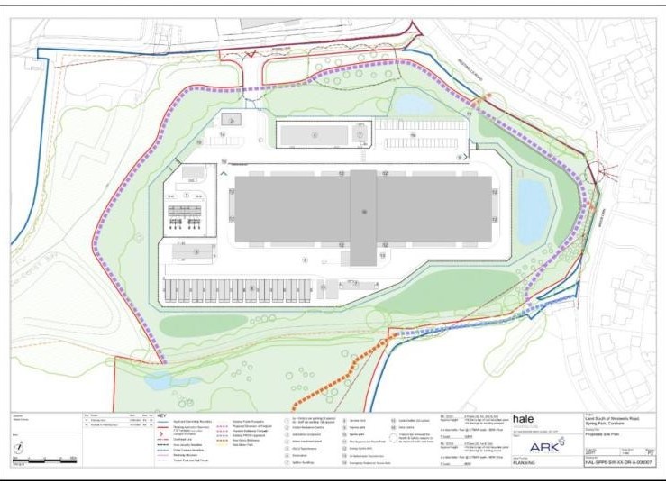
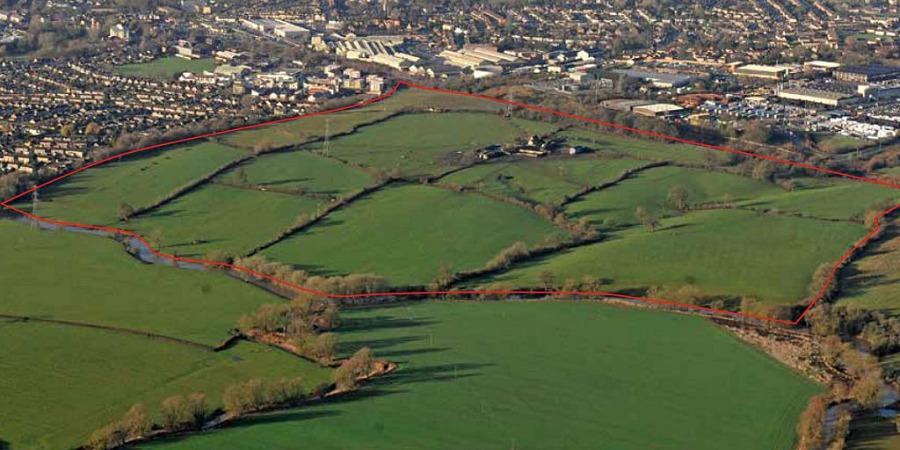
18th August 2025 - a further missive from Neston Westwells Action Group (NWAG) about water usage by data centres along with a request to send any comments you may have on planning application PL/2024/05527 to Wiltshire Council Planning may be found in the .pdf file below. The scale of the proposed data centre at the Donkey Field site (Ark Data's seventh) may be seen in the plan below which shows Rowan Lane running along the west and south of the site, Westwells Road along the north and Westwells along the east.
Adobe Acrobat document [70.2 KB]
20th July 2025 - the latest missive from Neston Westwells Action Group (NWAG) with regard to the proposed Donkey Field development may be found in the .pdf fie below
Adobe Acrobat document [93.7 KB]
A Times article of 19th July on data centres may be found in the .pdf file below (note that the download of the article necessitated it being split over two pages)
Adobe Acrobat document [9.2 MB]


21st June 2025 - a further article from Trudy Davies on the possibility of turning the Donkey Field into an industrial estate or campus may be found in the file below:
Adobe Acrobat document [62.4 KB]
20th May 2025 - an article by Trudy Davies of the Neston Westwells Action Group (NWAG) regarding the local strategic plan and the proposed Ark data centre at the Donkey Field in Westwells may be found in the .pdf file below.
Adobe Acrobat document [191.6 KB]
Also, see the 30th May 2025 article here: 30th May 2025 article

16th September 2024 - A tale of a Field, Flood and the ARK
(Text from Trudy Davies and Natalie Williams, photos by Paul Turner and Vic Steadman)
A lot of villagers are enquiring about what is happening regarding the Donkey Field. A small group of Westwells residents have been trying to find out and this is the story so far. ARK, a private company, has applied for planning permission to place a data centre on it. For anyone who doesn’t know what a data centre is, it is a huge building where massive computers are stored to manage and organise digital data in a gated secured complex. ARK already has 5 data centres just off Rowan Lane and has obtained permission to build another, number 6, on the old Stephen’s Plastics Site. They now want to build number 7 on the Donkey Field. Number 7 will be a massive industrial unit, so enormous a jumbo jet could fit inside it with room to spare! It is gigantic. It will be 18 metres high and even higher when cooling units are fitted on the roof. The ARK plan is to use mature trees to try and mask the building but given its size this will not work for at least 50 years. It would take a wooded area of well-established mature trees, like the woods that the various developers have cut down over the years, to mask just some of this, as it is so massive. Given the life span of the data centres, including the computers and the buildings themselves, the centre will be life-expired before the trees even reach third floor height. ARK plan to place this huge industrial unit only metres away from the houses on Westwells Road. These houses will be totally dominated by it. Some residents in Wadswick Green and the Greenhouse will actually be looking straight at its roof, as they are on the hill behind it.
If you are not already aware, data centres require massive amounts of electricity for them to function and people who live near other centres complain of power disruption to their homes. As the government has recently declared data centres to be ‘essential infrastructure’, like hospitals, in any emergency situation such as flooding or power grid failure, data centres will be given priority over local residential needs. Pretty much all the massive power consumption used in a data centre is converted into heat whilst the computers are operating. However to operate effectively the inside must be kept well below 27 degrees centigrade. To do this a complex cooling system is required which needs huge cooling fans the size of aeroplane propellers. These generate a continuous low frequency 'hum'. Already with the five data centres that are currently built, a lot of residents in Westwells are troubled by this continuous 'humming' noise and it is disturbing their sleep. This is before the data centre on the old Stephen's Plastics site is built on, which will increase the noise. Double glazing is no defence as the very low frequency can easily penetrate through glass.

Some villagers may not be aware of the light pollution that Westwells and Wadswick Green are already experiencing (see photograph below and gallery at the foot of this article). Also, Westwells is currently the focal point for an internationally recognised 'bat corridor' for over a dozen species of bats, many of which roost in the old mines/quarries. The Bat Conservation Society are concerned that lightning up the night sky in this way is affecting the bats homing instinct and ability to feed.
Contrary to some speculation, the Donkey Field has never been owned by the MoD; this is ‘fake news’. There is a clause in the national planning framework that allows ex-MoD land, where evidence of construction has not been assimilated by the environment, to be declared as a ‘brownfield site’. Hence the previous developers ‘claim’ and also the haste with which all the old foundations were scraped clear of vegetation, fruit trees and plant life and then sprayed with herbicide by previous owners (see photographs elsewhere e.g. here: Donkey Field destruction). During World War Two the site was requisitioned by the Ministry of Works to put temporary accommodation units on it. Afterwards, in the 1950s, the hutments were cleared and the land was returned to Bath and Corsham Quarries Ltd who used to work Sands Quarry. The whole site was subsequently sold to the garage owner on Westwells corner, which of course is now long gone. Until the 1990s it had almost been wholly assimilated by nature. So, for approximately 70 years, the Donkey Field has passed through a succession of property speculators but always acted as a buffer zone between Westwells, the MoD sites further up the hill and Neston. More importantly, it has also acted as a natural sump for surface water running down from all the high ground surrounding it. Under the Donkey Field there is the old Sands Quarry and the rainwater constantly drains into it (heavy rainfall towards the close of 1868 caused the quarry to flood and in late November, water began to rise in the lower end at a rate calculated at 60,000 gallons an hour. There was enough water in the quarry to fill a lake equal to three-and-a-half acres in extent, averaging 9ft in depth - this equates to 8.5 million gallons). Water drains into this area as Westwells lies in a hollow surrounded by hills. Some residents may not be aware, but ten years ago [Sept 18th 2014] some properties in Westwells were flooded, because of heavy rainfall. Westwells has no surface water drainage system. Seriously absolutely none! Due to the heavy rain even the old quarry filled up and the rainwater had nowhere to go other than down the foul sewage drain. When the sewage drain could not cope the overflow tried to follow the old river bed to the east. This old surface route to the head of the Bide Brook, at Spring Lane, was blocked off years ago by MoD landfill. The absence of an effective escape route for the water led to the flooding of cars, gardens, the play-park and homes. The water was a metre deep. The downpour lasted from about 10pm to 6am and water stayed on the Donkey Field all the next day. The emergency services were involved. (The water was deep enough for a child to kayak on the Donkey Field the following day). What a disastrous night, especially for the residents in Westwells who were flooded. However, this tsunami of water did not just stop there, it did more devastating damage to homes in Corsham and sadly much of this flooding stemmed from Westwells surface water run-off. Some residents in Corsham had raw sewage flooding through their homes and consequently they could not return to them for over six months. Devastating!

As a consequence of this flooding problem, when planning approval was given to build houses on the Donkey Field a 'Grampian Order' was placed on the developer. This order stipulated that before building could commence the builder had to sort out the drainage problem to prevent flooding which is not only historical in the Westwells area but is also reflected on the Floodriskmap.gov website. (Look it up and put in your postcode.)
The developers who were going to build houses, did not sort out the drainage problem and sold the land to ARK. The plans that ARK have put forward do not present a solution to the risk of flooding occurring again to the Westwells and Corsham area. Some Wiltshire Council departments are also very concerned and have put their concerns in writing on the Council planning website. So, if people consider residents in Westwells are NIMBYs please think again. The hamlet of Westwells has been around since the 1500s and although a bit soggy, hence the ‘wells’ and ‘springs’, apart from flooding in the mines and on the roads, there is no record of catastrophic surface flooding like that of September 2014. However, it appears that all the surface construction up Westwells Road, most of it by ARK, has now left nowhere for the water to go except the Donkey Field, the sewers and our houses!
The ARK consortium asked Wiltshire Council planners for more time so they can ‘revise’ their application and they are currently being given several weeks. There will be another opportunity to comment on the revised application once it is placed on the council planning website. Please read the documents on the site, many of the objections are compelling and soundly based on facts and practical experience, not just opinion: you may even feel the urge to comment yourself.
We are assured that global warming will bring increasing extremes of rain and heat. Once the Donkey Field is built upon there will be nowhere for the rain water to safely go. So the proposed build is not only exposing Westwells and the surrounding area to more noise and light pollution but also to an increasing risk of flooding and flood-related pollution. Not only to Westwells, but also to Corsham, Lacock and the river Avon which the Bide Brook empties into. This is before another 180+ houses are built on the Rudloe 2 site at the top of the hill.
All this risk, to provide only seven jobs; five data workers during the day and two during the night. If you feel inclined to do nothing else, consider the light pollution that is already affecting the bats and please comment on the Wiltshire planning site to at least help them! The Wiltshire Council ecologist has objected to the development proposal as, amongst other things, "There are likely significant effects on SAC* bats through impacts to foraging and commuting routes as well as roosting sites". The current planning application for the new data centre is designated PL/2024/05527 and may be found here on the Wiltshire Council website: PL/2024/05527. The deadline for representations (comments) was 30th August 2024 but in view of the issues (formal and otherwise) that have been raised, Ark will be submitting a revised application in the coming weeks (look out for it!). A photograph of the light pollution from one of the existing data centres adjacent to Rowan Lane is shown above and further photos may be found in the gallery below. And there follows a piece on how this proposed development will affect the public rights of way that cross the Donkey Field.
*Bath and Bradford-on-Avon Bat Special Area of Conservation

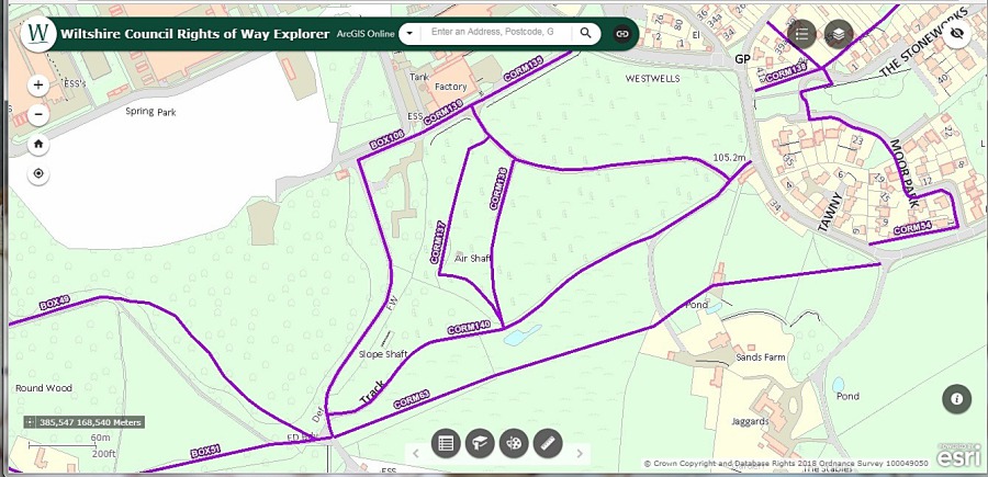
Potential impact of the application on the public rights of way which cross the Donkey Field
The reader may realise that a data centre on this site would put paid to the public rights of way that cross the Donkey Field. Jeanne Doohan fought long and hard to have the Donkey Field footpaths shown in the map above listed back in 2000. A planning application to divert the footpaths was made a few weeks after the data centre application.
Wiltshire Council Public Rights Of Way (PROW) department has stated that the only legal pointer in this instance is if the planning application for Ark Data Centre is passed. If it is passed, PROW is legally obliged to move the footpaths through a Public Path Order (PPO). Once made, a PPO is circulated as appropriate, advertised on site and in a local newspaper and is subject to a 28-day period during which objections or representations may be received. The council may decide to abandon a PPO or it may be determined (i.e. passed). It is only after determination and confirmation that the definitive PROW map is changed.
If the data centre planning application is successful, it is the PROW team’s responsibility to find the best outcome for the public, ensuring continued connectivity and, where possible, improvements to the network. A few residents met with the Rights of Way Team in August 2024 to discuss necessary changes to Ark’s plans, and these included ensuring all the current trees remain in place and the footpath meanders around them to make it more of a woodland walk and less of a running track. No gates (or stiles) will be allowed on the paths and they should be wider (to 4 metres) to allow for wheelchair and bike use alongside the walkers.
The following gallery of photos by Vic Steadman illustrates the light pollution emanating from existing data centres which are further from the Westwells and Moor Park habitations than the proposed new data centre.


Also see the 1st October 2024 article here: 1st October 2024 article
10th February 2021 and apologies for the extended news gap on the proposed Donkey Field development. Those 'in the know' will appreciate that much has been going on behind the scenes as the speculative developer Summix through its agents HD Town Planning and Marrons Planning, appealed Wiltshire Council's refusal of planning permission and the issue, as with the Redcliffe, Park Place development (see Bradford Road News) and the Stafford/Gladman 'Land north of the A4' Pickwick proposal (see Pickwick News), has been placed in the hands of the Planning Inspectorate. Apart from the representations made at the time of the planning application, further representations have been made by local people direct to the Inspectorate in the form of 'statements of truth'*. The Neston Action Group's rebuttal of the appeal includes much historical information which may be found in the .pdf file here:
Adobe Acrobat document [5.2 MB]
The formal start date of the appeal was 27th April 2020 but the actual appeal hearing (an online 'virtual' session) took place over two days, 8th and 9th February 2021, with arguments being put by both sides (representatives of Wiltshire Council and the appellant). A third-party (unofficial) summary of the proceedings follows:
Adobe Acrobat document [436.8 KB]
*The 'statements of truth' may be found within the documents Third Party Comments, the first of which, dated 30th June 2020, is on Wiltshire Council's planning webpage for application 18/09884/OUT along with other relevant documents associated with this application.
7th October 2019 and planning application 18/09884/OUT has been refused by Wiltshire Council planners (in their refusal notice dated 20th September 2019) for four principal reasons:
- It is located outside the development framework and does not relate to settlement strategy
- Insufficient detail has been submitted to demonstrate that the development can be adequately drained
- Insufficient detail has been submitted to ensure that the ecological value of this site would not be unacceptably affected by development taking place
- The proposed development fails to provide and/or secure adequate provision for necessary on-site and, where appropriate, off-site infrastructure
Interesting that the refusal notice includes in its arguments, in relation to housing supply, that 'the indicative remaining requirement for the Corsham Community Area (CCA) remainder is 0. This proposal is not required as part of housing supply'. However, the fact that no more development is required in the CCA (outside Corsham Town) is not given as one of the reasons for refusal! Perhaps this is because this state of affairs has been extant since (even before) the publication of the Core Strategy in 2015 and could and should have been used to refuse the Bellway, 88-home, greenfield development at Rudloe. Even now, the GreenSquare housing association is in the early stages of a so-called 'Rudloe regeneration' plan which would bring scores of unrequired new homes to the original Rudloe Estate, increasing density and bringing about the demolition of Rudloe Community Centre which was completed only in 2002 at a cost not far short of £1 million!
Many good arguments against the Donkey Field development have been made by Neston locals such as Tim Awmack, Charlie Graham and Fiona Hutter. But it should not be forgotten that similar arguments should have been made, and should continue to be made, against other local developments which involve the loss of green fields and community facilities and which will see housing density increase but with no additional services proposed. Even now, a Rudloe mother with a child who started school in September could not be offered a place at Rudloe's school so, being an ardent Green activist, has to cycle to Atworth with the child every day.
11th November 2018 - the expected, speculative planning application for the Donkey Field has been lodged with Wiltshire Council and has received the designation 18/09884/OUT. The deadline for representations on this application is 29th November 2018. Below the following photograph of the Donkey Field at the turn of the century there is a file 'link' to the comprehensive objection from Neston Action Group to this speculative application.
Microsoft Word document [26.0 KB]
The Wiltshire Council documentation for the planning application may be found here: 18/09884/OUT. The application form itself doesn't fill the reader with any confidence as the true applicant's name and address are not given (the agent's name is given with an address of 'Land south of Westwells Road!). One wonders what the applicant has to hide. Also, the application documentation leaves much to be desired; it is extremely 'thin' and disorganised. For example, the supposed 'Transport Doc Part 2' contains nothing about transport ... and there is no Part 1! Wiltshire Council's Drainage Engineer has recommended 'object' (rather than 'support') in his report here: Wiltshire Council's Drainage Engineer report as there are many significant drainage questions which have not been addressed in the documentation.
July 2018 and Summix's 'Projects' webpage illustrates the company's rapacious nature. The Rawlings Green site comprises approximately 50 hectares of agricultural land located on the eastern side of Chippenham. Land at Browns Lane, Tamworth is situated on the northern fringe of Tamworth; adjacent to the large conurbation of Perry Crofts. It comprises 12.89 hectares of agricultural land. Land at Hamilton Lane is located on the eastern fringe of Leicester and extends to 18 hectares. Land at Cowan’s Camp Depot, Oxfordshire comprises approximately 9.7 hectares of mixed brownfield and greenfield land. The Rawlings Green site comprises approximately 50 hectares of agricultural land located on the eastern side of Chippenham.The site comprises approximately 7.95 hectares of land located on the northern edge of Trowbridge in Wiltshire. Harrington is a large site, adjacent to Junction 7 of the M40, comprising 500 hectares of land capable of providing a new planned community, with all the facilities required and expected for a population of over 15,000 people.
The following photographs show some of the agricultural land that will be lost to Summix's projects.
 Chippenham
 Tamworth
 Leicester
Speaking about the 'UK Climate Change Risk Assessment 2017' programme, Defra minister Lord Gardiner said: "Our changing climate is one of the most serious environmental challenges that we face as a nation and that is why we are taking action, from improving flood defences across the country to securing our critical food and water supplies". Daft question but how can we secure our critical food supplies if we continue to build on agricultural (and potentially agricultural) land? In west Corsham alone, greenfield developments (Redrow, Redcliffe, Bellway) are swallowing up more than sixty acres of agricultural land. At the Rawlings Green site in Chippenham, mentioned above, 124 acres of agricultural land will be lost. This state of affairs, we know, is being repeated across the country with many tens of thousands of acres of agricultural land being lost to development.
A number of public rights of way cross the Donkey Field. These were fought for, long and hard, at the turn of the century principally by Jeanne Doohan. These rights of way are shown in the following map - the principal, cross-field path without a label is CORM135 (Wiltshire Council will amend the map).
Wiltshire Council's Countryside Access Improvement Plan 2015-2025 describes the importance of the Countryside Access Network (CAN) as follows:
The CAN is important because it: • provides attractive routes away from roads both in the countryside and within towns • helps Wiltshire’s residents keep physically and mentally healthy • forms a significant part of our heritage • enables people to enjoy the beauty and tranquillity of large parts of the countryside that cannot be reached by road • can be a wildlife habitat or provide green corridors’ between areas of habit
Including rights of way within a tarmac and reconstituted block development flies in the face of these aims; who would want to exercise their 'right' by walking through a modern estate? A map of the proposed development is given below with the rights of way indicated by dotted lines.
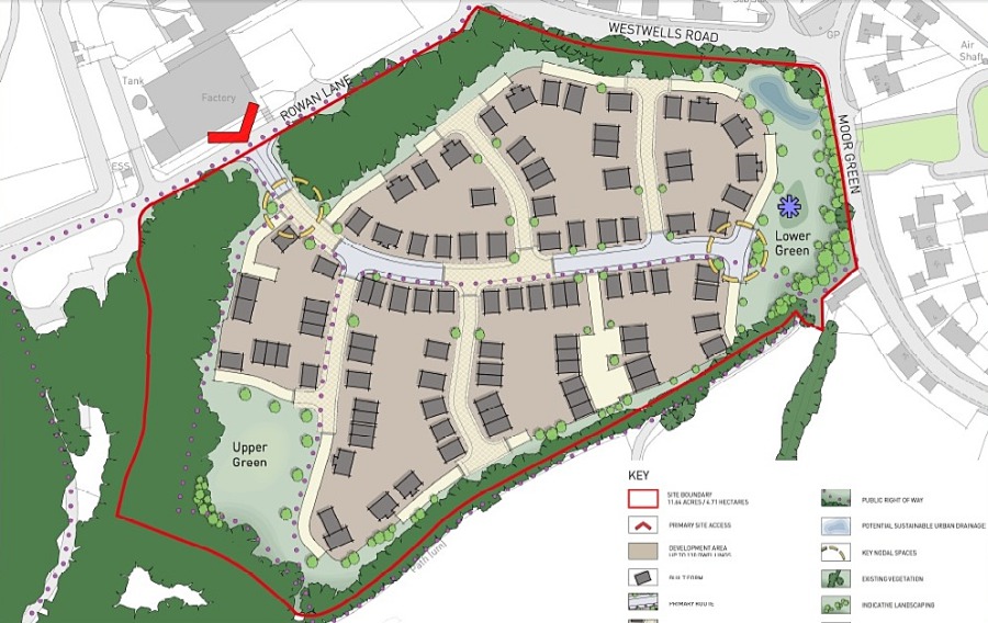
The 'full' development proposal, including the map shown above, may be found in the following file:
PDF File [5.4 MB]
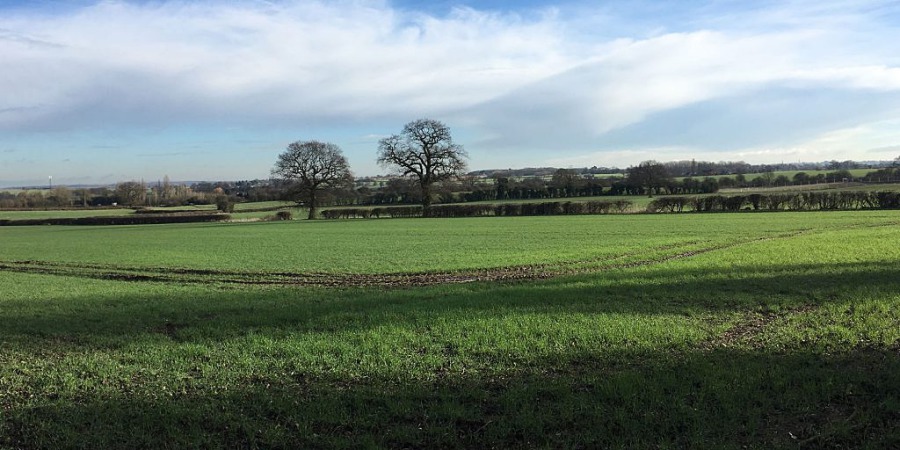
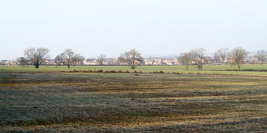
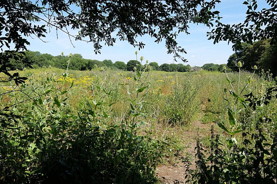
There are a number of factual/historical inaccuracies in this document but 'we' won't provide the speculator with ammunition by detailing them here (not that there's much chance of remote developers chancing upon this website). The photographs below show the Donkey Field in all its glory on 7th July 2018.
 The Donkey Field entrance from the cinder path showing the teasels which are frequented by goldfinches from late summer onwards
 The Donkey Field with Rowan Lane trees beyond; thistle, ragwort and great mullein, or Aaron's rod, much in evidence here
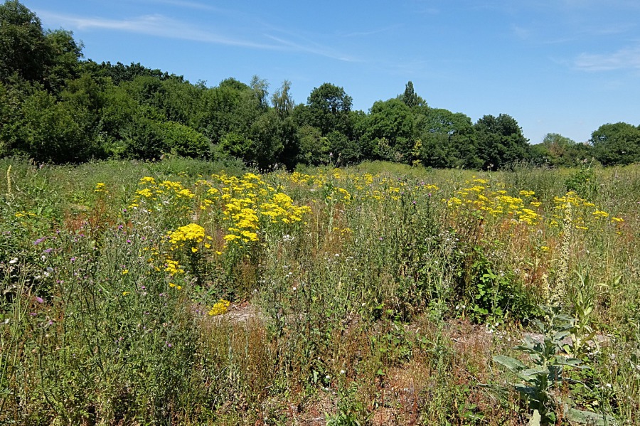
 'Summer Gold' ragwort with a stand of hedge parsley behind. 'Summer Gold' as this was the description given by a West Country farmer who used to sell it with such an appellation in his farm shop ... a tasteful vase of ragwort on the sideboard anyone?
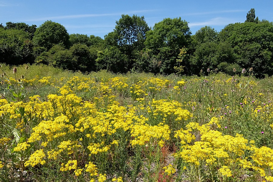 More 'Summer Gold' with the goldfinches' favourite, teasel, beyond. 'Teasel' as the spiny heads teased out separate fibres of wool before spinning.
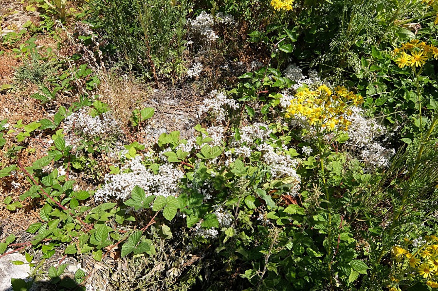 White stonecrop (sedum album) which is, apparently, fairly uncommon but it is prolific in the Donkey Field
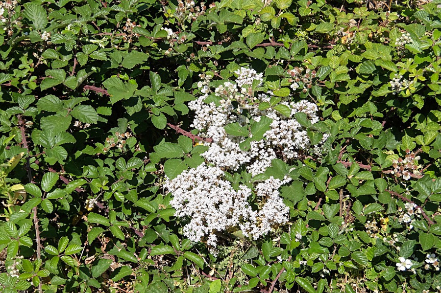 Told you is was abundant in the Donkey Field - here it is again in a bramble patch
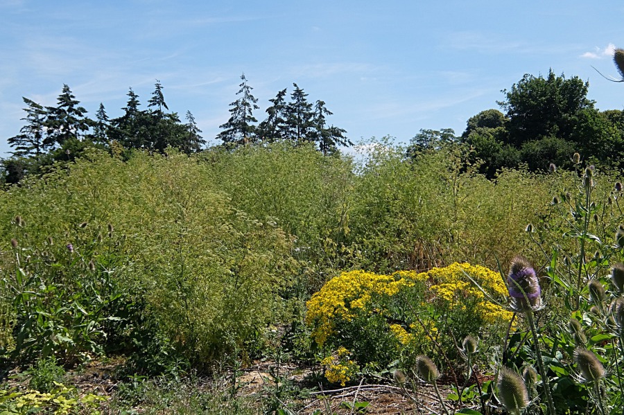 Here we have teasel, ragwort and a grand stand of hedge parsley with the conifers of Moor Park behind
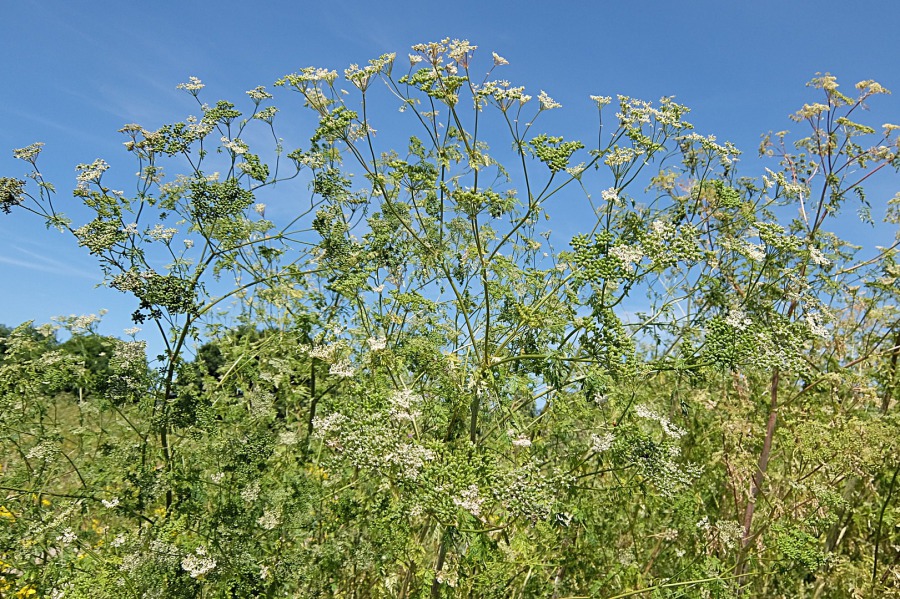 The flower heads of hedge parsley (Torilis japonica); as may be seen in other photos, this is abundant in the Donkey Field
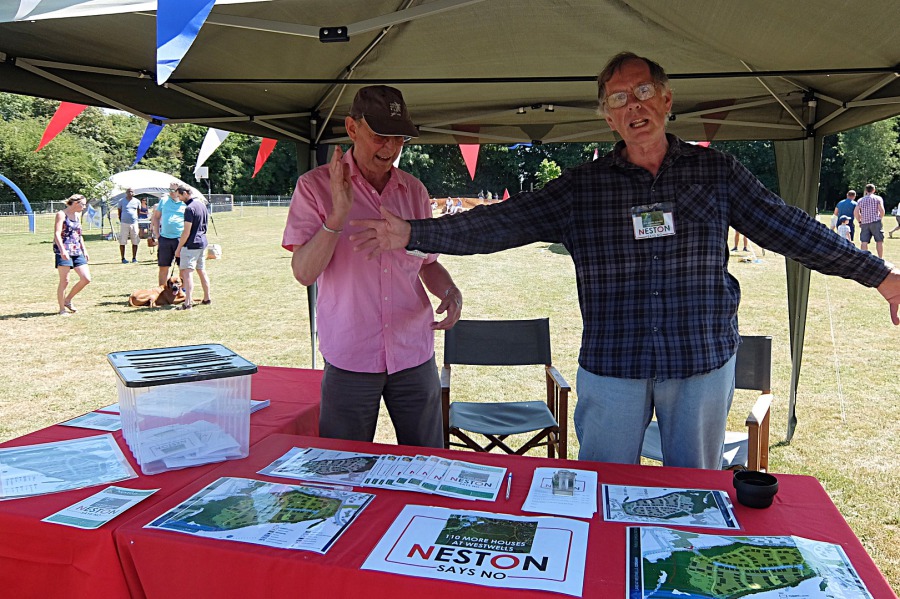 Kevin Hunt and Jeremy Brook at the 'Neston Says No' (to Westwells development) stand at Neston Fete on 7th July 2018
The 2013 Corsham & Box Matters article, to be found through the button below, remains relevant although, in the case of the Donkey Field, it is the landowner and not a local farmer to whom we may attach the appellation 'tyrant'.